Hi guys. I think we are all speaking apples and oranges here. I will address this to all 3D models (@roger-knight, @howdoiknowthisinfo) and acoustic models (@greg_n) creators.
1- Mercator projection bug: If use a placemark location on Google Earth with Mercator projection (UTM), it will truncate the Latitude and Longitude value after you save the pin. That will offset the position up to 1.4m.
The solution is to use the Decimal Degree on Tools>options and then convert to meters. This way the placemark will maintain accuracy up to 0.11m.
Conversion for this location (not equal to UTM ; This conversion was obtained by measuring 0.01 degree near the location):
Lat(m)= Lat(degree)*11105021
Lon(m) = Lon(degree)*8429686
2- Satellite image reference: we have at least 9 images dates. The images have different off-sets to geolocation. Here are the locations of South East lower corner of building 6 for 8 of the satellite images.
The images differ up to 2.5m.
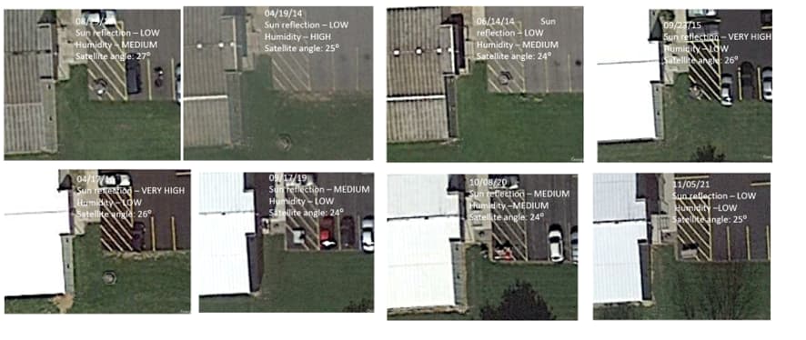
The solution is to pick the best image for everyone to use. Here are the best 8 images. I classified them by Sun reflection (which makes the roof white saturated), Humidity (which makes the image blurry), satellite angle (which distorts the image projection on the ground).
I removed the 5/17/23 because it’s too blurry. For me the best images are 09/23/15, 04/17/16 and 11/05/21 with sharp edges and lines.
The 11/05/21 have less sun reflection. Also, this image has the trees without leaves. with makes a good reference for using the trunk of the trees as reference points. This is the satellite image I’m using.
3- Satellite angle projection error. The satellite has an approximate angle of 25 degrees on image 11/05/21. Measured by the projection of Building 6 height projection of 1.4m and the real dimension of 3m.
This distorts the perception of a position on a higher ground. For example, the real location of Crooks position is 1.86m to the East of his apparent position on the roof, considering his height is around 4m. The same correction applies to the south and north barn snipers. Their real position is 2.6m to the east.
4 - Photo superposition error. For matching of references of the photo on the Google image we must agree to same rules:
4.1- Always disable 3D buildings
4.2- Always use the closest objects on the photo to the point of interest. For example:
At Trump location, I use the light poles as references. In my 3D model I tested 4 images and resulted in an error of 1m on Trump position.
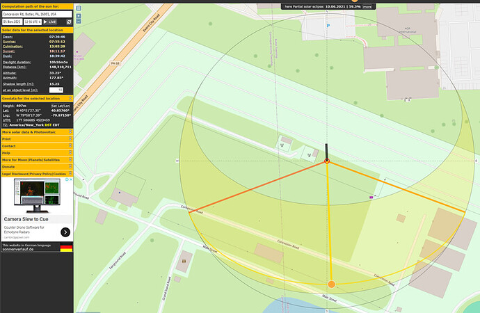
Obs.: Using this site, I found the angle of the shadows on light poles a manage to find the shadow azimuth angle (178.42 degrees) at the exact time of the satellite photo (11/05/21 at 12:58). A 10m object height on this satellite picture (11/05/21) will project a 15.25m shadow.


