Hi VT,
I understand what you are referring to.
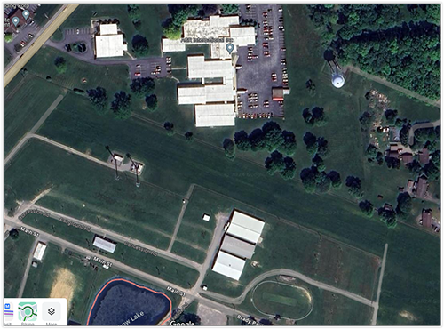
We don’t have a perfect top view photo, especially the total Butler ground. I am using the below picture I got from Google Maps which is a very good basis. Shortly after I posted how to put together the Trump rally footprint and aligning it with the Google Maps dirt paths, 3 days later Google Maps deleted that photo and put one without them. If you don’t believe me go back in history on Google Earth or read this post:
I see you were the one who gave me that tip about the history button in Google Earth ![]()
One idea that came to my mind to solve this problem of the slight top view offsets, would be to ask @rough_country_gypsy again to go out and take a perfectly centered top view of the entire butler grounds. He could use the tall lamps to orient the drone, when the poles are not in sight would mean that he is perfectly “top view”. The higher the better. But not so heigh that rough_country_gypsy loses his drone. ![]()
As you know rough_country_gypsy already gave us the perfect front view of building 6 with his drone of which we are all so grateful for. Once again thank you gypsy!
Or a perfect top view from building 6, a perfect top view from the middle grounds and a perfect top view from the stage position. Maybe somebody could then help us put together a very accurate top view reference basis to work with.
