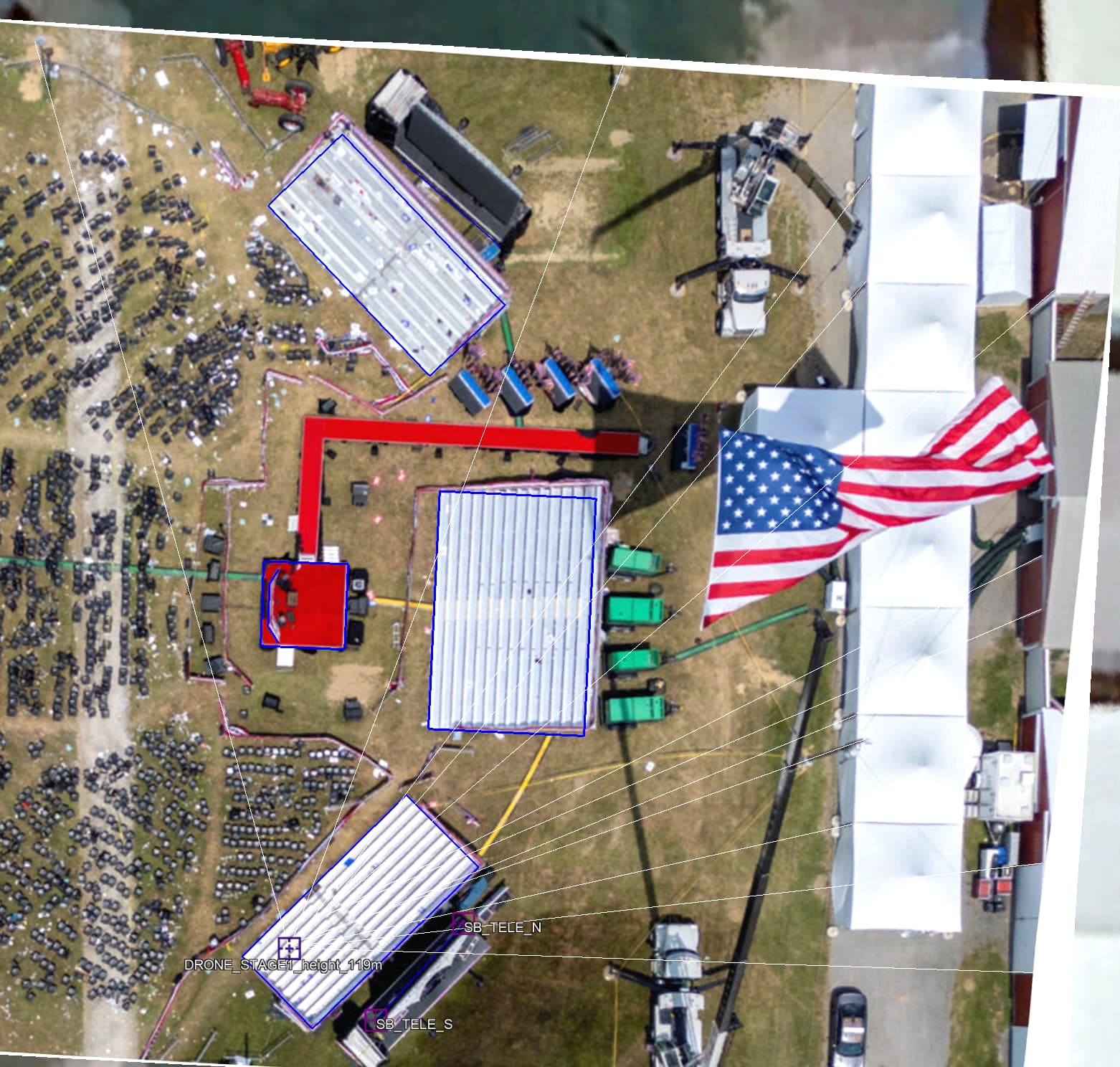
Here is the drone image. I think it’s in the best location for me. I used all the vertical lines from the white tents, the barns doors and light poles to estimate that position. All the vertical lines converge to the point of perspective where the drone took the picture.
This is how I know the elevation, because considering the height of the side of white tent (3m) I can trace back to drone elevation.
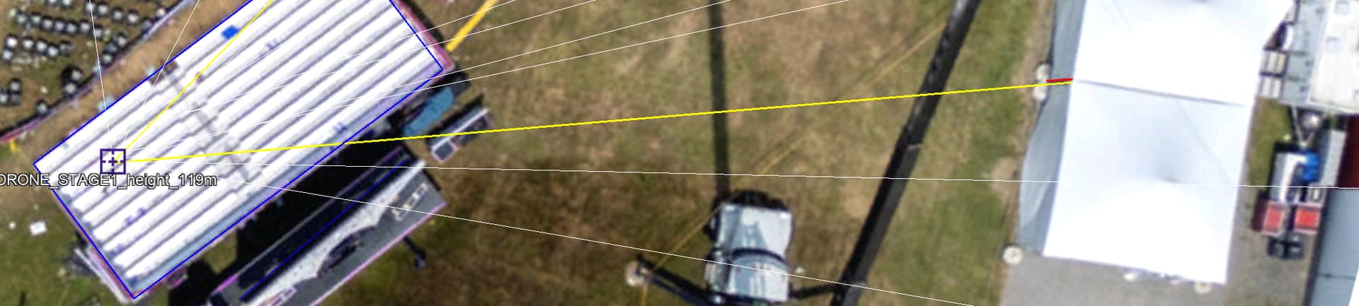
This dimension in red is 0.92m and the yellow dimension is 34m. Considering that the tent height is 3m it possible by triangle similarity to calculate the elevation of the drone.
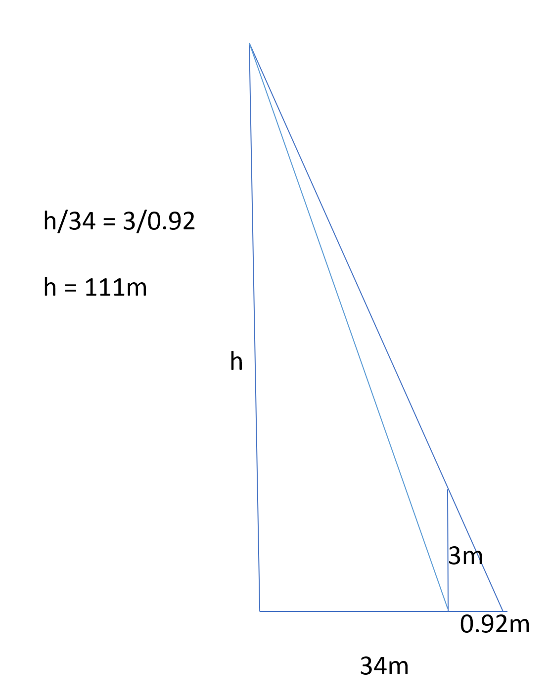
This estimation resulted in 111m, in other cases I achieved higher results. I considered the medium of them all that resulted in 119m.
This way now I can do the reverse and with a known elevation correct the bleachers and the teleprompter positions. Note that all the Bleachers in blue rectangles also trace back to the point of perspective. Also, the resulted bleacher in blue is a perfect rectangle with right angles and the sizes of the North (13.6x5.97m) and South (13.6x5.92m) bleacher are almost same.
For Crooks position I used the correction for elevated positions, which dislocate his position on the roof 1.5m to East because he is around 3.8m in elevation to ground.
This will happen to any roof in the satellite image. As you can see the east side of the building is due to the satellite not been exactly vertical to that location, but at an angle close to 24 degrees.
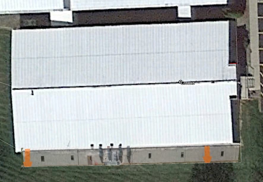
So, any geolocation in an elevated position to ground must be corrected. Also, you can see the projected image of the south wall dislocated to East for the same reason, in this case the dislocation is 1.4m to East. This makes a lot of difference when trying to make lots of images from the same footage result in the same location.
Also, I always use the 05/11/2021 satellite image, because the most sharp and clear image.
And I do not use the 3D buildings activated.