The 1350.2 elevation is beyond (north) of the peak approximately where the shooter’s head supposedly was. 1351.7 was an estimate of where the shooter’s head would be above the point noted above.
The ground elevation south of the building is around 1337 but the terrain dips to 1334 starting at 1337 30ft from the building and sloping down toward the building, leveling off to 1334 about 10ft from the building. The building footprint is carved out of the surrounding terrain.
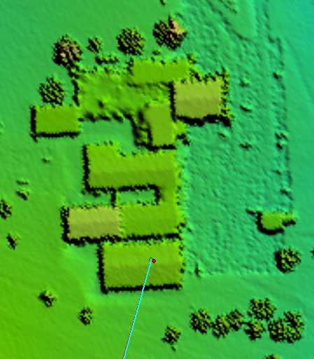
Source of data is USGS National LiDAR Dataset. I downloaded the LiDAR and made the DSM from it.
You want me to export an XML file for you so you can bring the surface into CAD?