Hi daniloraf,
No, not at all, simply sometimes people put out baseless claims and we take the time to debunk it and instead of giving feedback to the answer, you see the same baseless claim in another post from the same guy 3 days later. This to me is more of a distraction from getting to the truth. I really appreciate your answer, and I can see you are not one of those guys that is trying to create confusion in this forum, you seem to be an honest guy.
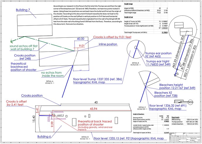
a) The floor level height is the most challenged topic in this drawing and I can only recommend for those who don’t understand the way we got the accurate floor levels is to follow the suggested crash course in this topic. Land ID has provided us with high accuracy topographical floor levels. With this, you are able to measure anywhere you want within the entire butler boundary. So all you need to do is to measure the slop from the AGR building to the position where Trump was standing. It will give you very accurate information about the heights of this terrain. In addition, as I mentioned before, in Gary’s video he reconfirmed our heights of which he used a high accuracy drone. So using two completely different methods and getting the same results confirms that we are very close to reality.
b) The way I proceed is I wait until I get a considerable amount of small changes in the data. These are people from this forum who give their feedback and challenge the data. When the claim seems to be legit, I integrate it into the next version, kind of like an update. Now we are at version 5. So probably you are looking at version 4 or lower and seeing some differences. I always mention the data points that have been changed when I come out with a new update.
So feel free to ask for any data that you are not able to understand by indicationg the ref. point.
![]()
