Dear Chris,
Referring to your Video of today: “Audio Analysis Most Consistent Two Shooters At Trump Rally - Peak Prosperity” I watched with great pleasure. I would like to comment on two points:
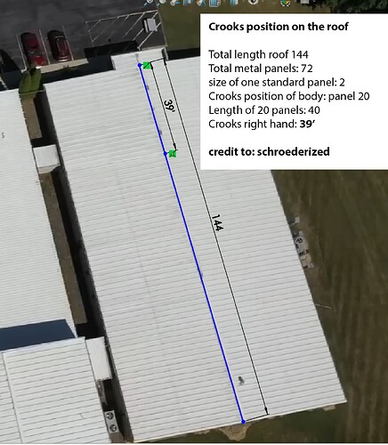
First of all, you showed my post with the position of Crooks. Unfortunately, that was simply a wrong screenshot I put on there. schroederized could clarify the exact spot of Crooks right hand in post 193 It is at 39 feet. Maybe you want to show this corrected position in your next YouTube to avoid any confusion for any other independent investigators. Below is a self-explanatory Picture
2nd point: I would like to challenge DMonk’s drawing you showed on todays show. He starts at floor level of 1331 bottom of stair case and ads 2 feet stair case, indicating the building 6 is at 1333 feet altitude. Our team at “Site Reconstruction of the Assassination Attempt” here on Peak Prosperity has discussed this topic many times. We claim the building is at 1335 feet height. The problem with programs giving out heights like Google Maps and probably CalTop is that they always give you the highest point. For example, if you click beside the building, you get the floor height of the side of the building, however when you click on the roof, you get the height of the roof. But we want to know the height of floor level of the building. Clicking beside the property is not accurate. This is why we should work with topographical maps, which only shows floor levels, even if there is a building on it. Google Earth Pro (downloadable for free) supports this feature. I recommend everybody to sacrifice 10 Min to take a crash course on how to measure slops in Google Earth Pro. Here is a link:
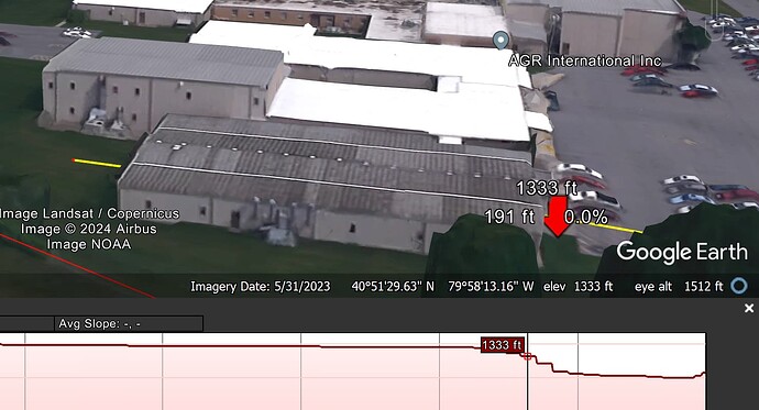
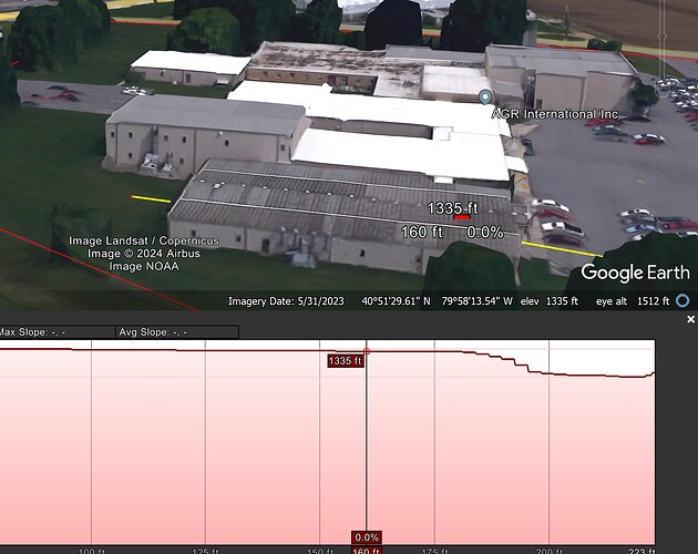
So if you use this method with Google Earth Pro, you can draw a line through the entire building 6 and you can see exactly that the floor level of the building is at 1335 and not 1333. This is a big game change if the building is 2 feet higher! Some people claim that Google Earth Pro is not an accurate source, you need to import topographical maps in KML format if you want accurate data. Fortunately, from a friend who has access to this data I was able to get the KML of the Trump Rally in Butler 2024. I am sharing this file here:
So everybody can do the following:
- Install Google Earth Pro for free
- Watch the crash course how to measure slops in Google Earth Pro
- Download the KML file from Google drive in the link below and double click on the file. Google Earth should automatically launch, and the Trump rally boundary should be activated in red
- Measure the slop of building 6 with the method you lerned in the YouTube video
- If you do everything correctly you can see the below screenshot which indicate two important things: The stairs that DMonks start is at 1333 feet and not 1331, the height of the floor of building 6 is 1335.
Please pass this information on to DMonks. In addition, we would like to get in contact with DMonk so that we can compare our data. Or even better he joins our community at this Forum: “Site Reconstruction of the Assassination Attempt”
Together we are strong!


