it is certainly true that there are things I do not know, but what about this?
let’s look at what your “manual” to determine the “slop” of a trajectory learns…
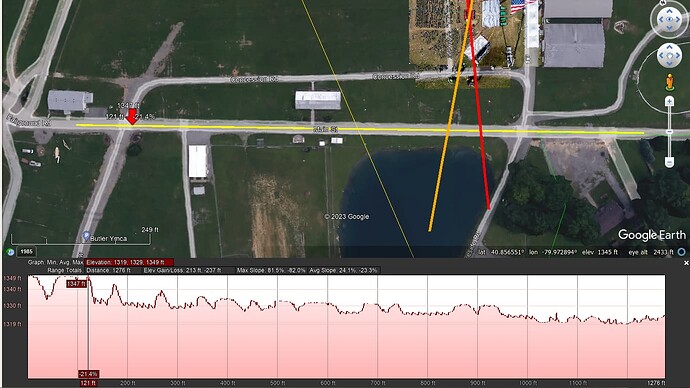
I think we can agree on the assumption that the main street next to the green of the rally area is a street which is reasonably even, not necessarily horizontal, but at least it is an even street, and certainly not humpy-bumpy up and down, right?
that street is indicated with the yellow line (near the red arrow pointing down:
well, let’s now look at the elevation profile of that path:
do you really believe that that road is so bumpy as is suggested by that elevation profile?
if you really believe that that elevation profile matches that even road, you are beyond hope…
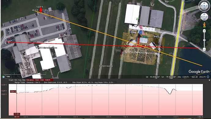
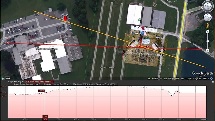
so, now let’s have a look at the elevation profile of the orange line that goes through the parking, over the location where Trump’s podium was placed and the pond:
if you honestly believe that in the above 2 pictures that first red arrow points at an elevation of 1324 ft and that second red arrow at an elevation of 1328 ft, you are beyond any hope…
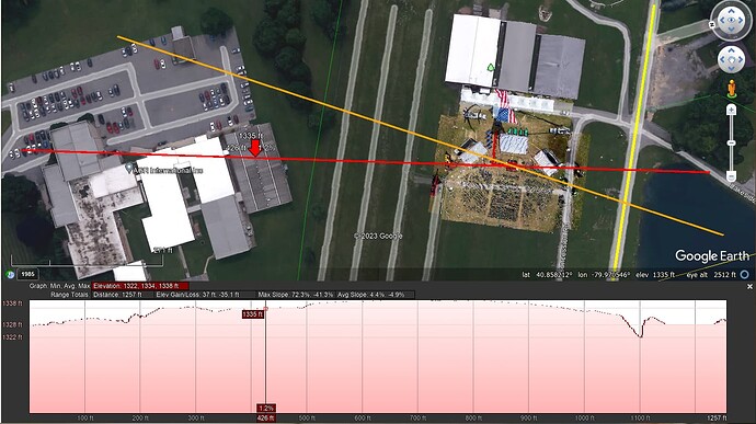
now, let’s have a look at the red path through the AGR buildings:
do you really believe that any of these elevation profile values are any reliable, let alone make sense?
- the pointer on the top of the highest building on this path shows 1330 ft
- the pointer on top of the white building shows 1333 ft
- the pointer on top of building 6 shows 1335 ft
these values do not make any sense whatsoever, and if you think they do, I have really no idea what is going on here…
if you think I am wasting your time by simply pointing out things you strongly believe in do not making sense, that is up to you, but I did everything I could to make it as clearly as possible that the reference values you swear by are not based in reality…


