I disabled the 3d building view in my google earth pro configuration now and removed the absolute heights of the ground overlays.
this has removed the image distortions of the overlay images.
basically, this means that the overlays are now a vertical projection of the surveyor plane’s view.
I am including your coordinates as-is in my trajectories plotting, so there should not be too much interference from the different angles and perspectives.
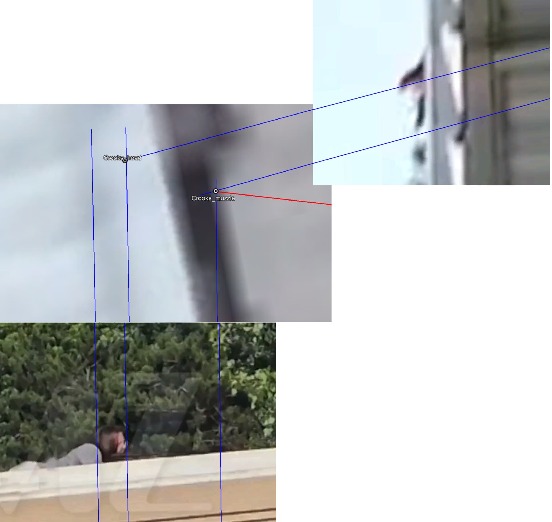
for the coordinates you use for the point “Crooks”, is that his head or would that be the muzzle.
if not, what would you suggest for the coordinates of the muzzle of crooks’ rifle, and would you put that at 3.8m from the ground too, or at another height?
cool.
it may have been that crooks started shooting at a roof lane more to the side of the AGR parking than where he was found dead.
so, if you could differentiate the muzzle positions from the roof lanes you think are reasonable, I can include these…
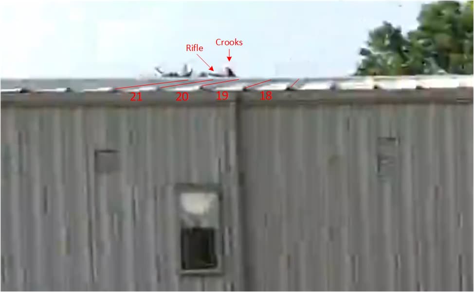
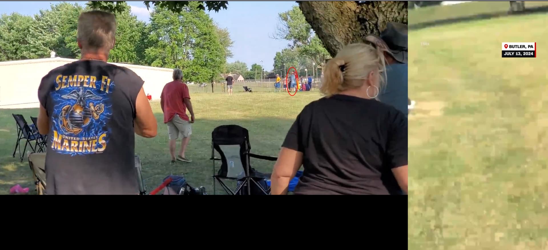
I had that impression too but after my detail analysis I came to the conclusion Crooks was in lane 20 when he fired the first shot. Since he had an angle to aim towards the stage, the rifle muzzle was half way into lane 21.
This is a screenshot from the Dayve Stewert video, about 1sec befor he pulled the trigger.
6 stairs of 8.25’+ pixel-degree conversion 1 fottage
410.357
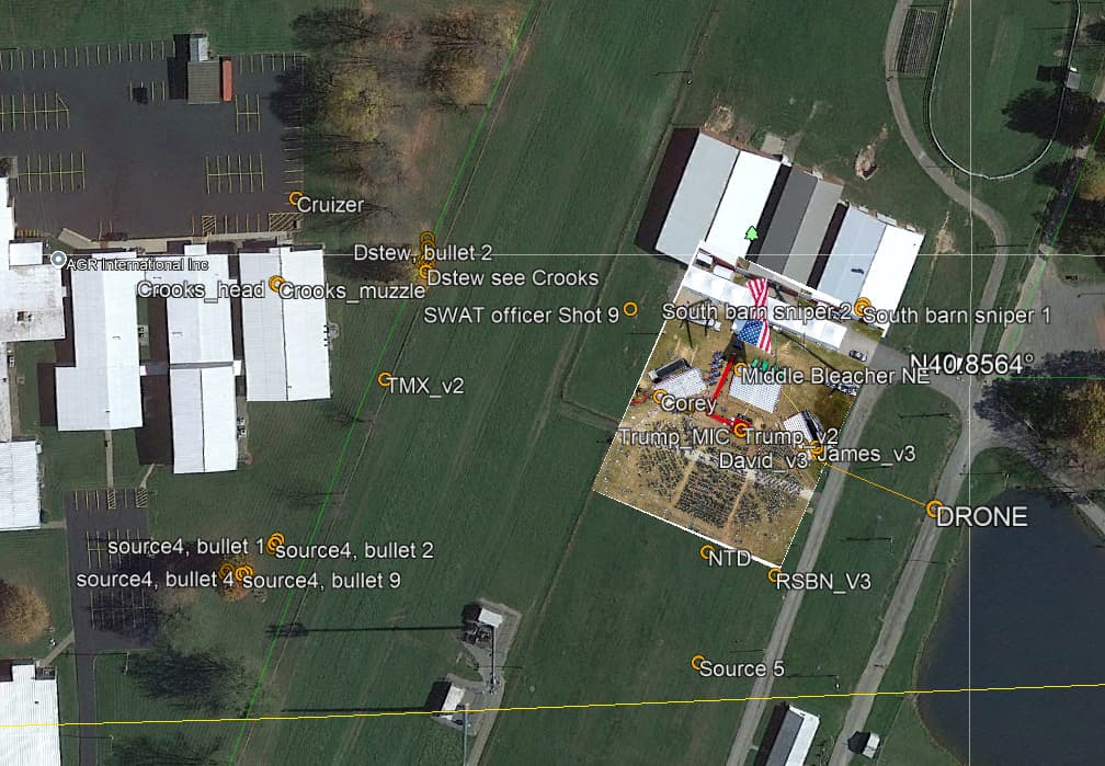
Trump_MIC
586726.64
4523394.28
40.85701706
-79.97101497
407.4
2.837
6 stairs of 8.25’+ pixel-degree conversion 1 fottage
410.237
South Bleacher lower
586722.47
4523376.15
40.85685428
-79.97106701
406.9
1.500
guess
408.400
TMX_v2
586740.37
4523498.02
40.85794999
-79.97083764
407.8
1.500
guess
409.300
Middle Bleacher NE
586744.48
4523394.30
40.85701539
-79.97080339
407.4
2.438
4 stairs of 8.25’ + guess
409.838
Dstew, bullet 1
586774.15
4523486.16
40.85783965
-79.97043855
407.1
0.894
pixel-degree conversion 1 fottage
407.994
Dstew, bullet 2
586775.89
4523486.19
40.85783967
-79.97041794
407
0.486
Dstew@1shoot - pixel-degree conversion 1 fottage
407.486
Dstew, bullet 3
586779.50
4523486.33
40.85784055
-79.97037502
406.9
0.500
guess upon fottage
407.400
Dstew, bullet 4to9 V2
586781.91
4523486.56
40.85784241
-79.9703464
406.8
0.300
guess upon fottage
407.100
Dstew, bullet 10
586775.11
4523488.07
40.85785673
-79.97042692
407
0.100
guess upon fottage
407.100
Dstew see Crooks
586772.23
4523486.67
40.85784445
-79.9704613
407.1
0.950
pixel-degree conversion 1 fottage
408.050
source4, bullet 1
586693.00
4523528.92
40.85823332
-79.9713953
408.3
1.400
guess upon fottage
409.700
source4, bullet 2
586691.84
4523529.60
40.85823957
-79.97140895
408.3
1.400
guess upon fottage
409.700
source4, bullet 3
586690.60
4523530.21
40.85824519
-79.97142359
408.3
1.400
guess upon fottage
409.700
source4, bullet 4
586683.23
4523537.98
40.85831595
-79.9715099
408.2
1.400
guess upon fottage
409.600
source4, bullet 9
586682.84
4523539.08
40.85832595
-79.97151437
408.2
1.400
guess upon fottage
409.600
source4, bullet 10
586683.83
4523544.57
40.85837024
-79.97151182
408
1.400
guess upon fottage
409.400
Ross_V2
586683.91
4523543.33
40.85836408
-79.97150106
408.1
1.460
pixel-degree conversion 1 fottage
409.560
Crooks_muzzle
586767.70
4523529.08
40.85822689
-79.97050914
407.041
4.080
pixel-degree conversion; altitude model B6
411.121
Crooks_head
586768.02
4523529.67
40.85823213
-79.97050518
407.041
4.050
pixel-degree conversion; altitude model B6
411.091
South barn snipper 2
586763.45
4523360.11
40.85670541
-79.97058311
406.9
7.466
pixel-degree conversion 2 fottages
414.366
South barn snipper 1
586762.39
4523360.54
40.85670938
-79.97059563
406.9
7.550
pixel-degree conversion 2 fottages
414.450
SWAT officer Shot 9
586761.86
4523426.72
40.85730557
-79.97059263
407.4
1.700
pixel-degree conversion 1 fottage
409.100
Cruizer
586793.39
4523525.12
40.85818848
-79.97020489
406.2
1.200
guess based upon cruize height
407.400
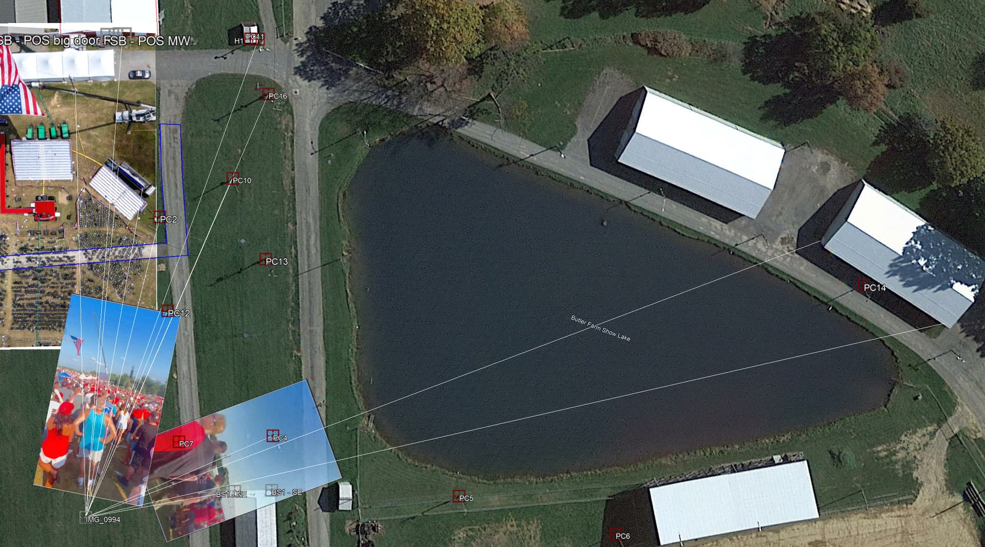
I found an error in Ross position, 0.4m. It’s corrected now.
The Crooks position (1st shoot) was corrected for his head and the muzzle.
Here is the positions zoomed and the line of sights.
@vt1 thank you, this is a gold mine for making sense of the report delays.
After correcting for your position changes, the largest report timing anomalies I have left are for the source you call TMX v2. You mark them as stationary. Their video is a spinning mess and I can’t tell what they are doing. Were you able to confirm which person was actually making this video and track their position and movements (I know they moved after the shots when they finally started pointing their camera intentionally)?
The whole audio timing triangulation solution now kind of depends on solving the position of this one source. No pressure
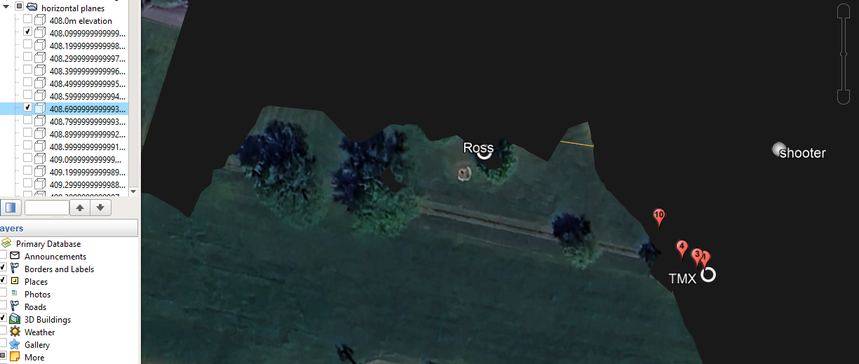
@vt1 , how did you derive your “altitude” column? Let’s look at Ross. If I use the “horizontal plane” data provided by @howdoiknowthisinfo, the ground level at Ross is 408.7 m. If I use Google Earth and do feet->m to get an extra digit, I also get 408.7 m. But your table says 408.1 m.
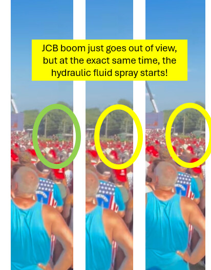
I recently discovered the footage I have been looking for for quite a while now, namely that where the hydraulic line of the JCB hydraulic lift is punctured.
it is filmed from a single location, for which I produced an informed guestimate in the following post:
it also provides an uninterrupted audio trace without moving a lot and without too much distracting noise…
could you have a look at this one too regarding your sound analyses?
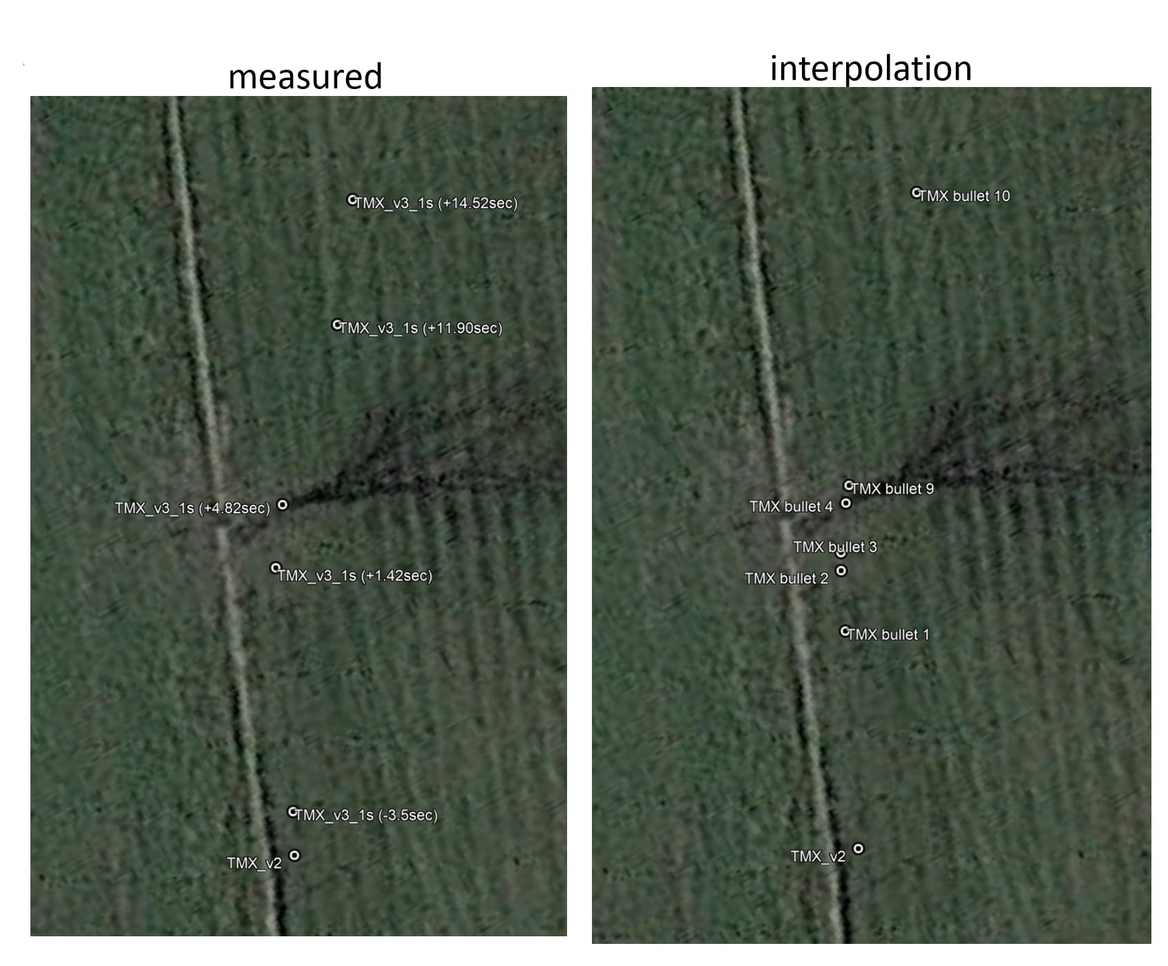
Already on it, discovered this today. I was wrong on this one. During the geolocations study I did not want to have my bias affect the results so did not look at the time differential off any source and the Podium, today I took a look I discovered exactly that TMX was indeed moving. My TMX_v2 position is only for the beginning of the fottage.
4 frames later, the JCB lift is just beyond the right hand side of the camera, as the recorder pans to the left, and at the exact moment that the lift disappears, the bullet causes the hydraulic hose to burst and the spray starts:
the two other stills are the two frames after this first spray frame…
I am using VLC to visualize this video, and it does not show me the frame numbers…
when I ask the “jump to time” information, I see this: 8194:26:40,000 at the frame with the green circle…
the (lon,lat,alt)-coordinates I use in the kml file for the impact at the hydraulic lift are: -79.97112266623199,40.85668312671275,3.12
the impact height of 3.12m is a very good guesstimate based on the exact brand/type-specifications of the John Deere tractor next to it, and the spray is exactly at the same height of that tractor’s roof from various angles…
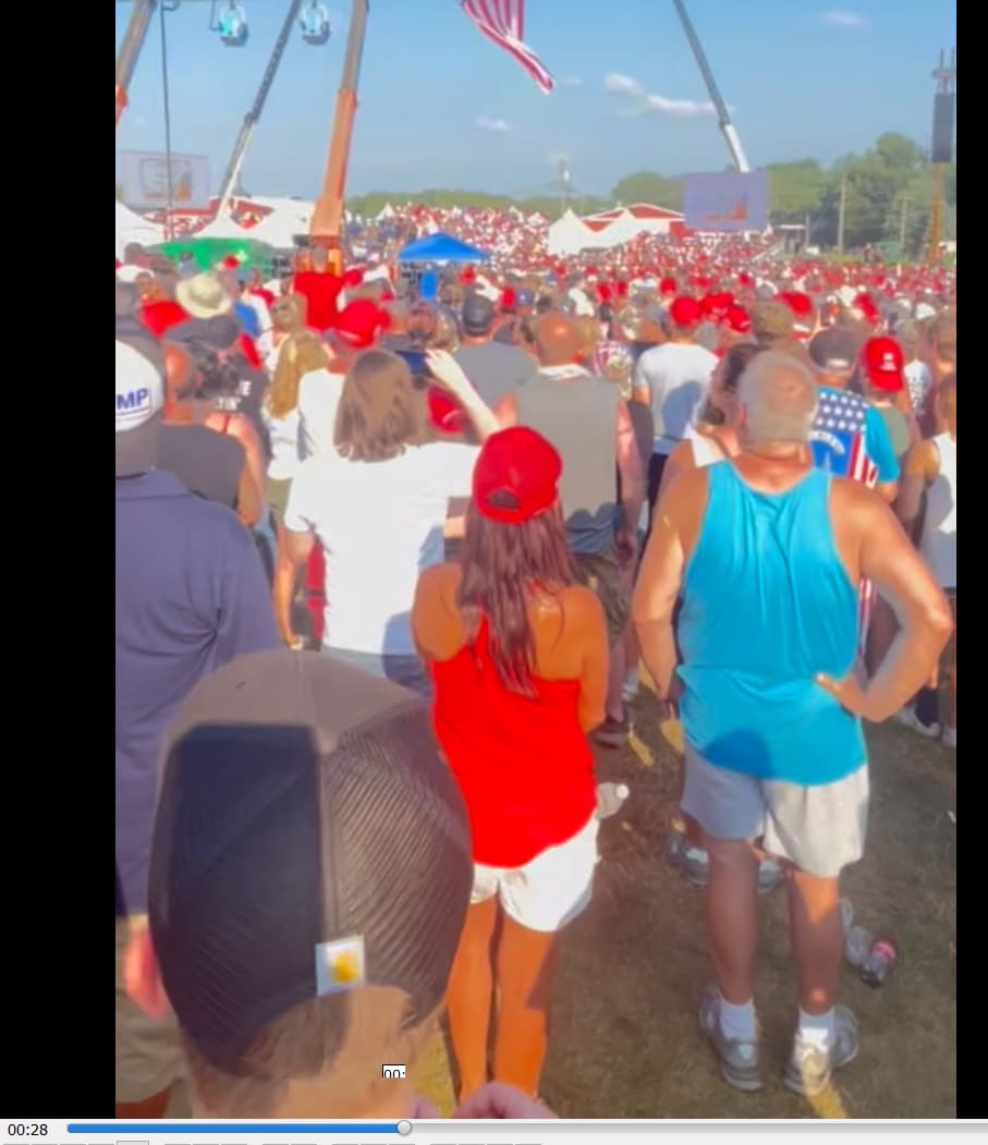
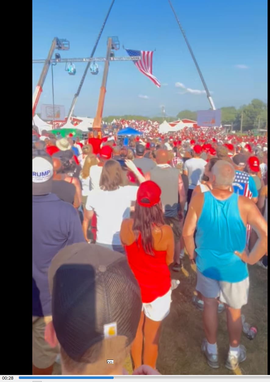
the coordinates for this footage is about -79.97205934066361,40.85717634199032
as far as the height is concerned, I would go for the same as what you use for the other chest-height human recorders…
Okay. I see it clearly now. It’s at 29.062, which is exactly at the same frame that we hear Shot 3. Was there already a consensus that shot 3 was the one the hit JCB hydraulic?
Nit pick: shouldn’t “fottage” be “footage” instead, my friend @vt1 ?
You seem to be “in a groove” for knocking out these difficult geolocations. So, how about doing “Ross!” at shot 10? He moved northward from the tree between shots 9 and 10. I have a pretty good idea of where he went, but you are obviously very good at this, so …