Hi guys,
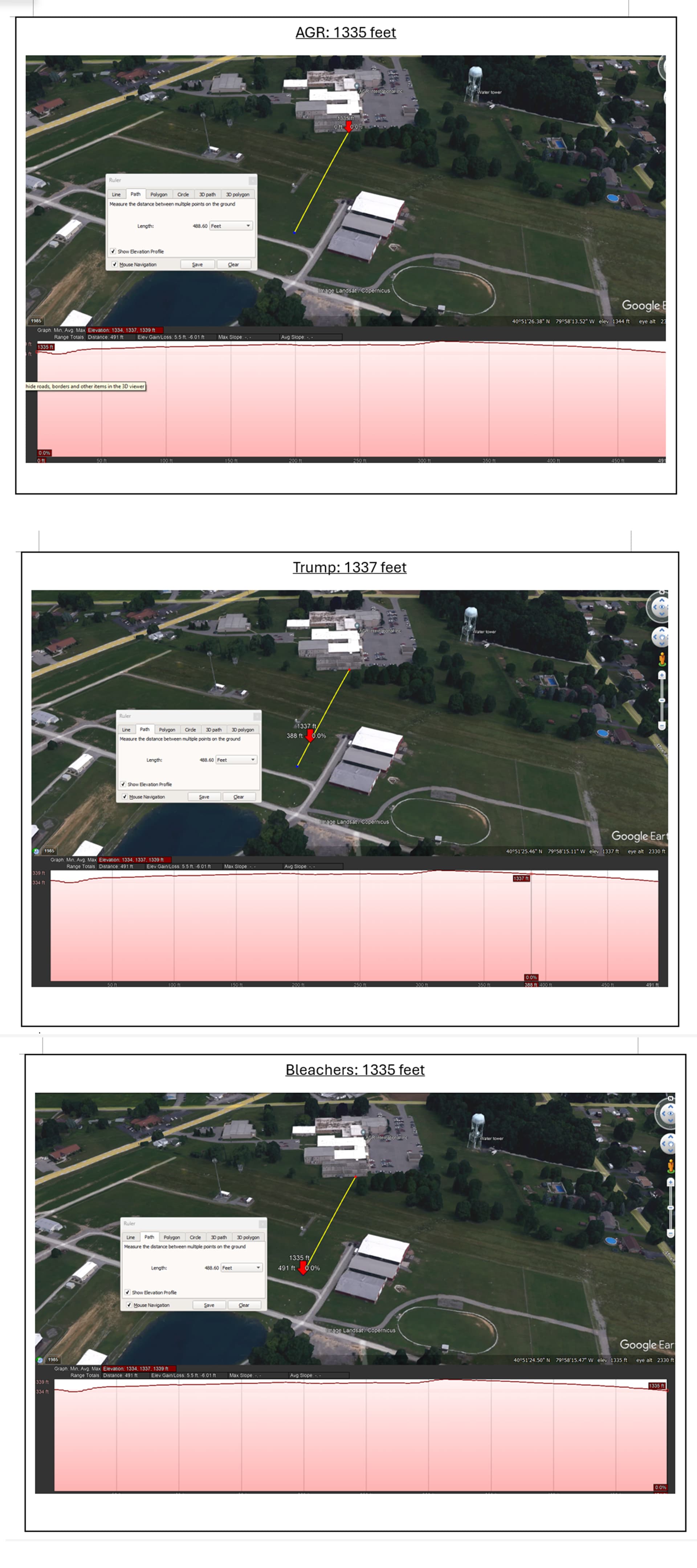
Thanks for all the feedback. The more we are the more accurate we get. Just to clarify, we should all be using the same software to avoid many questions and discrepancies. I have found that “Google Earth Pro” has the best ability to exactly point to the points of interest and to get the exact elevations. Please go ahead and download Google Earth pro for free, enter “Butler Farm Show Airport” in the search. There you can find our place of interest, then simply click the ruler and don’t forget to activate in the Path tab “Show elevation profile” Set the path of interest and you get the results as images below.